• Places
  • Blog
  • About

Wandering In South America

  • Places
  • Blog
  • About

Let's Get Outta Here

I finished writing a song a little while back that tried to capture the mindset that we were in before we went on this trip. I've been going through a lot of these pictures and videos, and am definitely going to be picking this up where we left off, since it's leaving out about half of our trip. I guess that doesn't quite count as travel blogging, since it's been almost two years, but I'm only going to forget more and more of it, so I figure now's as good of a time to pick it back up as any!

Also, I don't usually swear in songs, but sometimes it just feels good to do it a whole lot. Here's the song:


tags: music, south america, travel
categories: General Update
Wednesday 09.14.16
Posted by Alex Orellana
 

Choripan

Note: I just discovered that I had a bunch of drafts on this blog that I never posted for some reason. This one really stuck out, because I'm not sure what more needs to be said: Choripan fucking rules.


Choripan is the best thing ever.

I thought I've had chorizo sausage before, but I was incorrect. It's way different down here. I can't exactly put my finger on it, it's not spicy, it's a bit sweeter, it's not as tough as what I'm used to, and it's just goddamned delicious. Put it on an awesome roll and top it off with some chimichurri (also one of the greatest things ever) and some salsa criolla (tomatoes, onions, and who knows what else, in a vinegar based sauce), and you've got yourself something magical. I think I've probably averaged about one choripan every 3 days, so I'm going to recount some of the more memorable ones.

Freddys next to Mercado San Telmo

Desnivel on Defensa in San Telmo

Random vendor during the Pride festival in centro

Somewhere on El Caminito in La Boca

Backyard off of Defensa in San Telmo

tags: food, buenos aires, choripan, chimichurri
categories: Buenos Aires
Wednesday 09.14.16
Posted by Alex Orellana
 

Parque Nacional Torres del Paine: Logistics and Recommendations

On the boat ride back to the bus.

We took our time waking up on the last morning in the park, since all we had to do was take a boat and then a bus back to Puerto Natales. There are three or four boats from Paine Grande to a bus pick-up every day, the schedules are subject to change, but they usually were at 9, 12, and 5 while we were there. There isn't really much of a system to ensure that the boat will be able to fit everyone, it follows the same general rule of the park, which is "things tend to work themselves out". Which actually does seem to be true. All of the buses wait for the boat to arrive before leaving to their next pick-up, so we didn't have to worry about them leaving us. The boat ride back was absolutely astonishingly beautiful, and I'm glad that we decided to end the hike that way, because we were able to get an amazing recap of the park from a new perspective. Which brings me to the theme of this post:

How did we plan all of this and what would we do differently if we were to do it again.

First, here's a current map (as of December 2014):

If you're going during summer (December-February) I would recommend making reservations ahead of time wherever you can. But that is mostly just for peace of mind, because it really seemed like most people were just winging it, and it did appear to work out, more or less. In fact, the night we had a reservation for a platform to camp on in Cuernos (same price as regular camping), when we got there they said they were out of them and that they give them to whoever gets there first. But they did clear out a pretty decent location for us to set up camp, and at that point most people were setting up camps sardine-style in other sites or walkways, so it did still make a difference. There are two main companies that either own the land, or run the refugios/camps, in addition to state-owned free camps:


Fantastico Sur, they own a bunch of the land in TDP, including:

  • Refugio/Camp Las Torres
  • Refugio/Camp Chileno
  • Refugio/Camp Cuernos
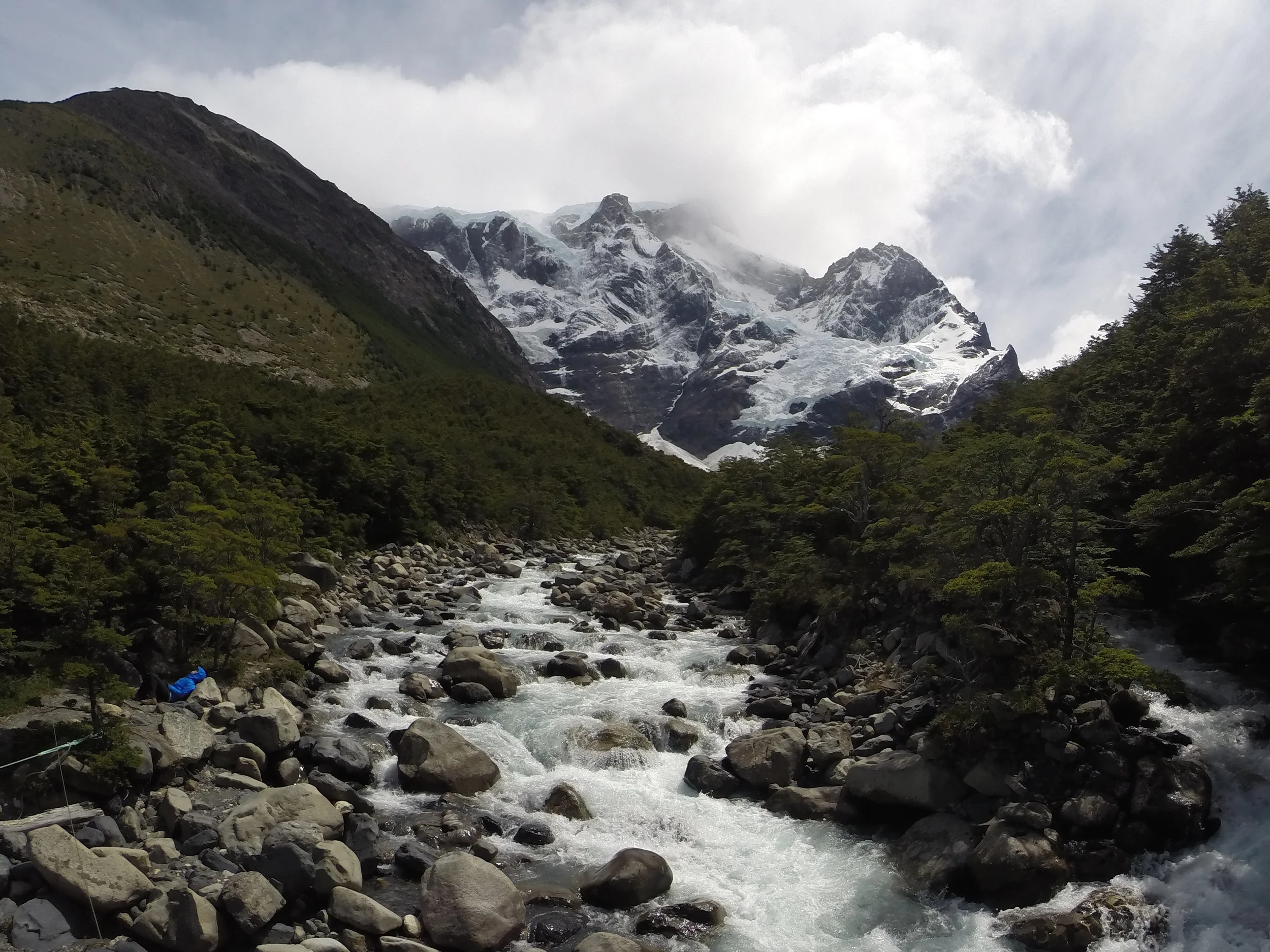
  • Refugio/Camp Frances (Between Cuernos and Italiano, not shown on this map)


Vertice, they run:

  • Refugio/Camp Paine Grande (formerly called Pehoe, which is what many of the signs on the trail still say)
  • Refugio/Camp Grey


State Owned, free, no way to make reservations ahead of time. They include:

  • Campamento Italiano
  • Campemento Torres (not to be confused with Las Torres at the bottom of the mountain)


Those are all the camps along the W, there are a few more if you plan on hiking the O, more state-run ones as well as a couple more owned by Fantastico Sur/Vertice.

We chose to hike East to West, and to do it over 7 days and 6 nights; 5 days of hiking, 2 for getting in/out of the park. A lot of people seemed to be doing it faster than that, but I felt this was a great pace for two people that are in decent but not excellent shape. We definitely took our time with breaks to take in the scenery and take pictures, and this rate allowed for plenty of that. Here's a quick recap:

  • Day 1: Took the 2pm bus to the park, arrived at Refugio Las Torres, set up camp, hung out.
  • Night 1: Camped at Refugio Las Torres, ate the prepared dinner.
  • Day 2: Left our camp all set up, hiked up to Torres del Paine and back, took us about 9 hours total.
  • Night 2: Camped at Refugio Torres, ate our own food.
  • Day 3: Hiked to Refugio Cuernos, took us about 5 hours.
  • Night 3: Camped at Refugio Cuernos, ate the prepared dinner (the food on Christmas eve was great!)
  • Day 4: Hiked to Campamento Italiano (2.5 hours), set up camp, hiked up Valle Frances and back to Italiano (6 hours). Note that Campamento Britanico and the end of this trail is closed as of December 2014.
  • Night 4: Camped at Italiano, ate our own food.
  • Day 5: Hiked to Paine Grande, took us about 3 hours.
  • Night 5: Beds in Refugio Paine Grande, ate the prepared dinner.
  • Day 6: Hiked to Glacier Gray and back, took us about 8 hours.
  • Night 6: Camped at Paine Grande, ate the prepared dinner.
  • Day 7: Took the boat and bus back to Puerto Natales.

I almost forgot, YOU HAVE TO BRING IN CHILEAN PESOS. If you're staying in Puerto Natales for a few days, take out cash as early as you can. We ran into the situation where it was the day before we were supposed to leave, and all of the ATMs were just out of money. We found a secret one in some gas station, which ended up being a huge life saver. We brought in about 175,000 CLP (about $280 USD) for the two of us, and we used every penny. Although, we could have spent way less than this if we skipped out on beer, but it's hard to resist a delicious beer after a long day of hiking. And I should add that we paid for our lodging and most of our meals ahead of time, so if you aren't reserving ahead, make sure to bring more (the rates will be on the above sites). 

This whole trek is pretty flexible, so if you're in a hurry, I might recommend the following route. If you go faster than this you are either a complete beast, or will be cheating yourself out of really taking in the scenery. I should note that there is no way I could have pulled this off myself at the time, I was definitely not in good enough shape. You can definitely make your own agenda too, just be careful of underestimating how demanding it can be if you aren't in peak physical condition. Times are less precise than above.

  • Day 1: Take the early bus to the park, hike up to Refugio Chileno (2.5 hours). [Or if you want to save some money and are feeling hardcore, go all the way up to Campamento Torres, which is just before the steep climb up to the mirador at Torres del Paine (1.5 hours from Chileno). This is particularly tough if you're bringing all of your own food, since this is the heaviest your pack will be and this is all uphill.]
  • Night 1: Camp at Chileno [or Campamento Torres].
  • Day 2: Start early, hike up to the mirador Torres del Paine (2.5 hours from Chileno, 1 hour from Campamento Torres) [the sunrise is supposed to be amazing, but you'll only have a chance at seeing that from Campamento Torres], come back down, pack your camp up, take the shortcut to Cuernos (4 hours from Chileno, 5.5 hours from Campamento Torres).
  • Night 2: Camp at Cuernos.
  • Day 3: Hike to Campamento Italiano (2.5 hours), set up camp, hike up Valle Frances and back to Italiano (6 hours).
  • Night 3: Camp at Italiano.
  • Day 4: Pass through Paine Grande and hike to Refugio Gray (7 hours).
  • Night 4: Camp at Refugio Gray.
  • Day 5: Hike back down to Paine Grande early enough to catch one of the boats back to the buses (4 hours).

It's definitely not a race, so I wouldn't personally recommend the second one unless you are an experienced backpacker, but we really did take our time, so doing some kind of combination of the two isn't a bad idea.

There's a lot of debate on the trail over if it's better to go East-West or West-East. I think the biggest arguments for either direction are: going West-East gives you a way better view between Paine Grande and Italiano, the wind generally goes West-East, so having that at your back is nice, and going East-West saves the beautiful panoramic lake ride for the end, so you can admire how far you've gone. These directions should work just fine in reverse, just study that map while you're planning it out and you should be ok.

It wouldn't be a post about Patagonia if I didn't include a bit about the weather. The weather can turn on you in a second, so prepare for the worst, just in case. You could tell who all of the new hikers were because they all had these giant neon sails on their packs called "pack covers". We entirely skipped that and just lined our packs with heavy duty garbage bags, which did the trick. Although, we got INSANELY lucky in that we had uncharacteristically fantastic weather for almost our whole hike. We had one day where it was raining, but it never got too bad, and we had already set up camp, so we weren't carrying our full packs. 

Hopefully someone finds this informative, if you have any questions, feel free to reach out!

tags: chile, torres del paine, W circuit, W trek, Torres del Paine W, patagonia, tips, hiking, trekking, how to, planning
categories: Torres del Paine
Thursday 04.09.15
Posted by Alex Orellana
 

Parque Nacional Torres del Paine: Day 4 + 5

The fourth day of our trek we slept (in) at Campamento Italiano, and started  the next day around ten. We filled up our water bottles at the base of  camp, one of the huge benefits of the park, delicious water everywhere.  

Filling up water 

Filling up water 

Flowers near the camp site

Flowers near the camp site

The hike to the next camp / refugio was two and a half hours, so we took our time. We planned on arriving at Paine Grande (camp and refugio run by Vertice) and relaxing for the rest of the day before we headed up to Glacier Grey.  Paine Grande is the  point of the W is where you catch the catamaran back to the buses, and back to Puerto Natales. You can either start you trek at Paine Grande, and go west - east, or like we did, start at Torres, and go east- west. We went back an forth about which hike would be the better. It really all depends on weather, which you never know what will happen. We crossed someone on the trail who said it rained all day, and we had perfect weather. And we were on the same trail. So it depends. 


We had a reservation to sleep in the refuigo at Paine Grande the night we arrived, which happened to be an accident. I thought it would be a bit of a reilef to sleep in a bed, but it's a bunk  situation, and we happened to be roomed with a group of heavy snorers. I think we prefer tents! 


We got up early the next morning, packed day bags, and hiked up to Glacier Grey. 


This leg of the trek is pretty long and steep, but worth every step. along the way, you get views of the glacier, and the glacier lake, so you have hints of whats to come.

First Glacier View

First Glacier View


The whole hike took us about 8 hours round trip, including a lunch stop. Once you get close to the glacier, you can really chose your own path, to how close you'd like to get. The trail just kind of ends, and you can just walk around. You also pass Glacier Grey Refugio along the way, which looked like the nicest Refugio we'd seen so far. 

View from the Porch of Refugio Grey

View from the Porch of Refugio Grey

Alex Touching Glacier Pieces 

Alex Touching Glacier Pieces 

Most of the hike back to Paine Grande is uphill, and uncovered, so it gets quite hot. This leg of the trail was crowded, but we were lucky again and had great weather. We camped at Paine Grande that night, one of the more crowded sites we met on the trail. It services as both the exit and entrance of the W and O, so it was understandably full.


Thursday 04.09.15
Posted by Alex Orellana
 

Parque Nacional Torres del Paine: Day 3

After our awesome night of Christmas Eve dinner, Christmas day promised to be much less cushy. The plan was to hike from Cuernos to Italiano (the only free campsite on our itinerary), set up camp, and then head out to hike up the Valle Frances and back to camp.

This is probably closer to what the hike really looked like...

But this is what it felt like. Because a large chunk of the W is on private land,  different groups of people make different signs, depending on where you're standing. This is one of the signs made by the official park service of Chile. The more hand-drawn ones are done by Fantastico Sur.

The first leg of the trip was really smooth, we breezed through it. Well, aside from that apparent wall that we had to climb, that was rough. I think that image is just ever so slightly exaggerated, however.

As we were rounding the corner up to Italiano, the valley that we were about to explore began to take shape.

Nikki walking toward Valle Frances, Cuernos del Paine on the right.

Italiano is one of the two available free campsites on the W (the other one being close to the base of the final ascent to the Torres del Paine, which we skipped to avoid carrying our packs). We got there around 2, which was absolutely perfect timing. Some people arrive at the camp late, and hike through the valley early in the morning, so those people were just about finished taking down their camps when we arrived, so we got some prime real estate. We left at around 3, which gave us about 7 more hours until dark. Going later in the afternoon continually paid off for us, since the W is generally pretty crowded (not like midtown Manhattan, but more like car-camping in a national park in the states), and for some reason everyone just needs to leave at 7am, so the trails feel much emptier during the last 5 hours of daylight (5pm-10pm during December).

It's one of those valleys that are actually mountains.

The trail in the valley definitely had some of the most diverse terrain in the whole park. One of my favorite parts was when the trail just turned into a gentle stream, it seemed like something out of a fairy tale.

Get good hiking boots.

It didn't take us long to reach an unbelievable view, so of course, we took a selfie.

You'd think I'd be better at not cutting off anyone's head at this point.

You'd think I'd be better at not cutting off anyone's head at this point.

The incredible thing about this spot is just how dramatically different the landscape appears depending on what direction you're looking.

Cuernos del Paine to our right.

Enormous glacier to our left.

More detail of the glacier.

The most impressive thing about this glacier is that since it's in a valley, you could hear loud, ringing thunder echoing around you any time a chunk of glacier fell from the cliffs. You can get a sense of how windy it gets in this neck of the woods by the amount of dirt and rock that has been blown onto the top of the glacier.

View behind us.

The river was a lot smaller once we made it up past the main glacier.

That shit is delicious.

As we were repeatedly warned, the weather can change in a heartbeat down in Patagonia, and this leg of the trip proved it. Pretty soon it started to rain pretty steadily, so we had to don our full rain gear.

Nikki rushed through the exposed rock field to get out of the rain, but I stuck around to take one of the many "is this an alien planet?" pictures.

Even though conditions were less than ideal, the view was still pretty spectacular in its own rain-filled way.

Despite being well-prepared, scrambling over loose rocks on a steep incline in the rain isn't that easy. We thought we'd never make it up to the top, and after making it to a pretty cool summit, we came across this subtly modified sign.

Those nails make me think this isn't temporary...

And just beyond that, additional subtle signage.

Warning tape and two more signs, seems like it might be a good idea to stop here.

We later found out that there was some rock slide activity and the end of the trail is closed until further notice. The good news is that we were standing in a pretty awesome spot, so it wasn't all for naught.

Standing on a cliff (well, from this angle)

We turned around after this, and began the fun process of understanding what our knees will feel like in 40 years. Everything looked a bit spookier on the way back, accompanied by the fact that we had the whole trail to ourselves. You can tell we were super thrilled about the weather:

Somehow, while the rain refused to stop directly over us, the sun was shining bright on the mountains to our left on the way back.

That is the place to be, apparently.

It wasn't too long after this that the combination of only eating a PB&J, my knees not being cooperative, and slippery conditions conspired to make me completely eat shit. Slipped on a root and totally bent my pole. I then had the brilliant idea to try to bend it back, which of course caused the tip to snap right off. Luckily I didn't get hurt outside of a scrape on my finger and some good old dirt battlescars on the jacket, so it could have been way worse. Glad I decided to get careless where the ground was nice and soft.

We finally make it back to camp with about an hour of daylight left to spare. We finished off the day with two more delicious PB&J's for our lovely Christmas dinner. Not quite as glamorous as the night before, but I'll be damned if that wasn't the best PB&J I've ever had.

tags: chile, trekking, W circuit, W trek, the w, Torres del Paine, Italiano, Los Cuernos, Valle Frances, French Valley, Hiking, patagonia, glacier
categories: Torres del Paine
Monday 01.26.15
Posted by Alex Orellana
 
Newer / Older

Powered by Squarespace.